GPX-files
Free downloads of all my favorite trails
The GPX-files are homemade by me, and should work with any phone, GPS watch and so on. I have done GPX-files for both hiking directions when relevant. Either direction is fine to choose, but you may want to read more details and tips in the info section of this website.
Day Hikes
- Amarminoen (27 km.) – End in Dragør (North to south) or Start in Dragør (South to north)
- Mølleåen from Øresund to Lyngby (12 km.) – Strandmøllen to Lyngby Station
- Skjoldungestien (31 km.) – Hvalsø to Roskilde or Roskilde to Hvalsø
- Aarhus-Silkeborg Trail (32 km.) – Aarhus to Silkeborg or Silkeborg to Aarhus
Multi-day Hikes
- Fjordminoen (51 km.) – Begin North of the Fjord or Begin South of the Fjord
- Gendarmstien (84 km.) – West-to-East (starting in Padborg) or East-to-West (ending in Padborg)
- Ringsted Adventure Trail & Køge Å Trail (50 km.) – Ringsted to Køge or Køge to Ringsted
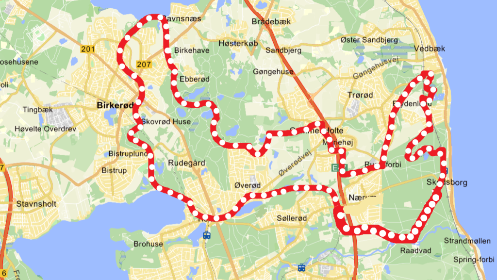
- Rudersdalruten (43 km.) – Clockwise (Nærum-Holte-Birkerød-Vedbæk) or Counter-clockwise (Nærum-Vedbæk-Birkerød-Holte)
- Øhavsstien/South Funen Archipelago Trail (130 km.) – Faldsled-Svendborg-Rudkøbing-Ærø-Faaborg (finish by ferry) or Faaborg-Ærø-Rudkøbing-Svendborg-Faldsled (start by ferry)
Copenhagen City Walks
- Copenhill (12 km.) – Clockwise or Counter-clockwise
- Vestvolden/Western Rampart (20 km.) – North to south or South to north